本文
City Outline
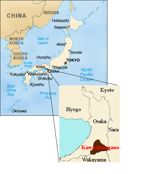
Kawachinagano is located in the southeastern corner of Osaka Prefecture. To the east lies the Kongo mountain range and Nara prefecture. To the south is the heart of the Izumi mountain range, which connects to Wakayama Prefecture. With its apex to the north, the land area of Kawachinagano is triangular in shape.
Although Kawachinagano is the 3rd largest city in Osaka Prefecture in terms of area, as much as 70% of the city is made up of forests and mountains. The small mountain plains, with the Ishi, and Ishimi rivers flowing alongside, open facing the north. There they join with the Kawachi plains, which continue to widen while moving northward.
A majority of the city’s area is a sandstone region with the inland area containing fertile soil and a moist, warm climate. With these factors, Kawachinagano is a suitable area for the cultivation of vegetables, rice, and fruit crops.